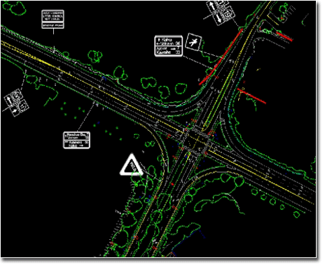
Migration of Microstation data (for 2200
maps) into ArcView shp format with attribute data
Data classification based on specified themes
Designing of user defined queries, such as :
What are the accident related data within an
user defined radius from a specified location ?
What is the length of a specific road segment and the
mass of material used ?